


 The sirens wailed through the congested lanes of Andheri. It was 4:37 a.m., and the fire control room had just received reports of a major blaze on the 19th floor of a residential tower. Traffic was minimal, but the narrow roadways and the sheer height of the building turned what should have been a routine emergency response into a logistical nightmare.
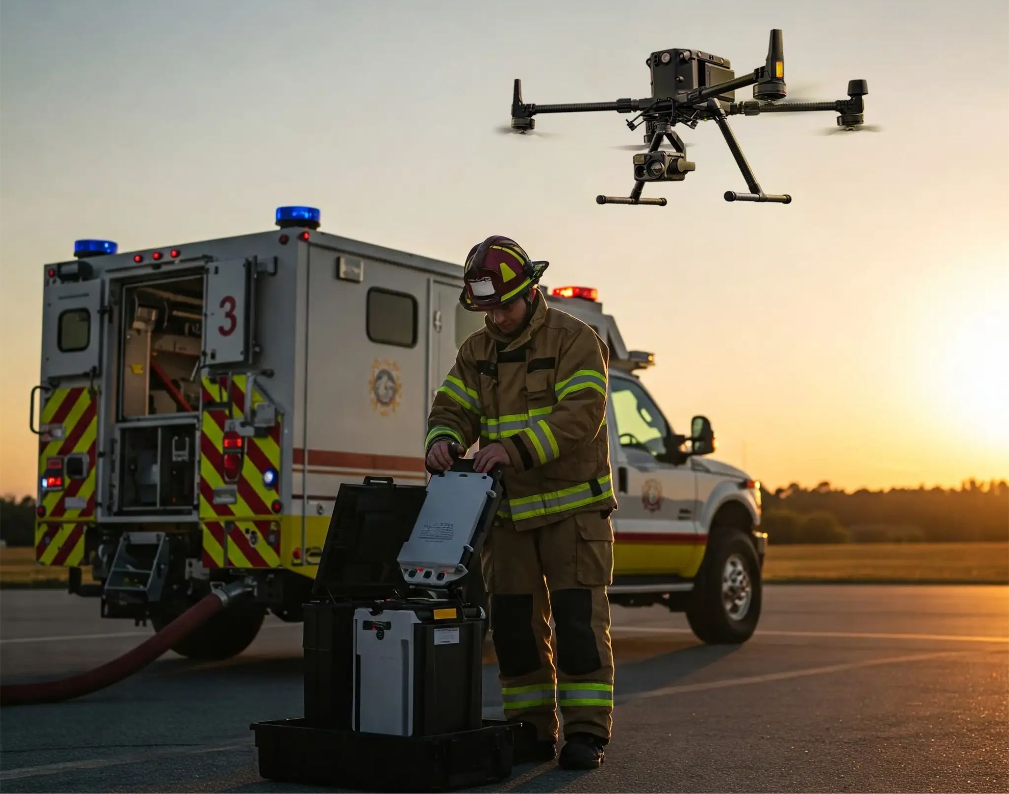
By the time the first fire engine arrived, the smoke had already engulfed the top floors. Visibility was near zero. Traditional ladders couldn’t reach the upper levels, and the heat made helicopter access impossible. But this time, the Mumbai Fire Brigade had a new ally — a small fleet of fire safety drones.
 Within ninety seconds, three drones launched from a nearby command van. Their rotors cut through the smoky dawn as they ascended rapidly, transmitting live thermal imagery to the command center. On a large screen, glowing heat signatures revealed not only the hottest fire zones but also movement—people trapped behind a glass façade. For the first time in India, the firefighters could see the invisible.
That night marked a turning point. Not only did the drones guide the fire teams toward the most critical zones, but they also detected structural weaknesses that prevented potential collapses. The operation became a case study in how aerial robotics could redefine emergency response in India’s rapidly urbanizing landscape.
Why India Needs Faster, Smarter Fire Response Systems
India records over 1.6 million fire incidents annually. According to the National Crime Records Bureau, more than 9,000 people lose their lives to fire-related causes every year, often due to delays in response and limited situational awareness.
The reasons are deeply systemic:
Traffic and accessibility: Fire trucks can’t always navigate through dense urban neighborhoods or hill-town layouts.
Vertical urbanization: Modern skyscrapers often exceed the operational range of standard firefighting ladders and hoses.
Industrial risk: Chemical, petroleum, and manufacturing facilities pose toxic and explosive threats.
Forest and rural fires: In states like Uttarakhand and Himachal Pradesh, fires spread rapidly across steep and inaccessible terrain.
Time, in every sense, is the enemy. The longer the delay, the greater the destruction. This is where drones promise a paradigm shift — speed, precision, and data-driven decision-making in real time.
The Rise of the Fire Safety Drone
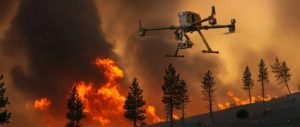
Fire safety drones are far more than cameras on wings. They are autonomous, AI-assisted aerial platforms designed to perform high-risk tasks with surgical accuracy. Their functions span from reconnaissance to active fire suppression support.
- Rapid Aerial Assessment
In a crisis, every second counts. A drone can be airborne in under two minutes, covering large areas that might take ground units half an hour to reach.
Equipped with thermal imaging cameras, drones provide live temperature gradients, allowing commanders to visualize the spread pattern of a blaze. Multispectral sensors can distinguish between active flames, smoldering embers, and safe zones — vital information when visibility is low.
Regulatory Modernization
The Directorate General of Civil Aviation (DGCA) can establish Emergency Drone Corridors (EDCs) — pre-designated air routes allowing immediate UAV deployment for public safety missions.
Skill Development
Incorporating drone operation modules into fire academy curriculums ensures firefighters evolve alongside technology. Simulation-based training can help responders master drone-assisted tactics under realistic conditions.
The drones relay information to an AI-driven operations center that generates an augmented-reality map for ground responders. Firefighters navigate with smart visors, guided by live overlays from the drones.
Within fifteen minutes, the blaze is contained – no casualties, minimal loss. That’s not science fiction; it’s the trajectory India is already on. they will be India’s next big rescue heroes.